Electorate data cards
Encourage students to explore how decisions can be made with this set of cards that use real ABS data.
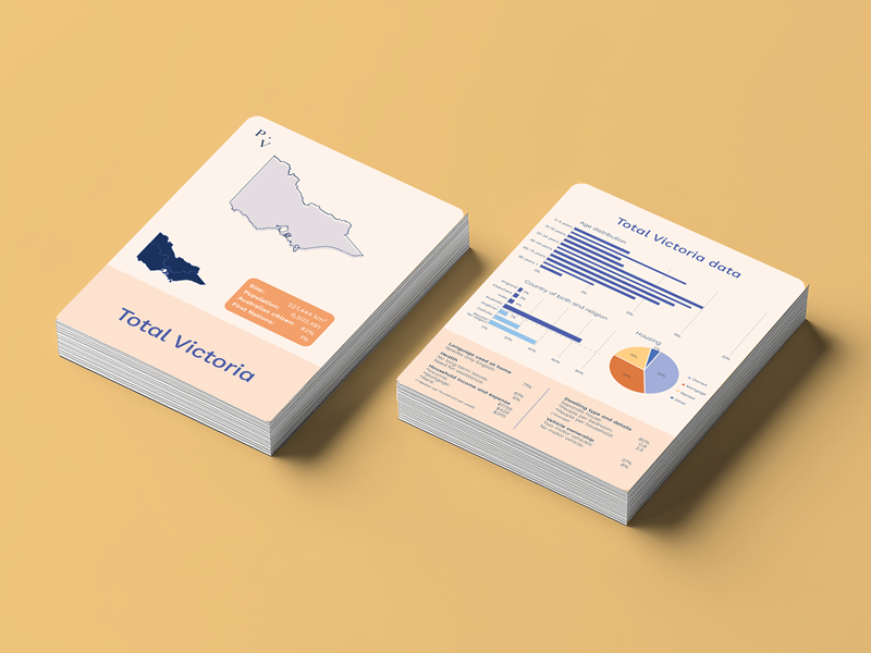
The Electorate data cards consist of statistics for each of the 88 lower house electoral districts, and for all of Victoria, from the last Australian Census in 2021.
Use the cards to explore:
- how members of parliament make decisions for their electorates
- population distributions in geography
- statistical representations and analysis
The data provided is a snapshot of some key demographic information such as age distribution and countries of birth, as well as size of the electorate, population, housing types, and some income and expense details.
The data is also available in Excel, with additional data not represented on the cards.
Download electorate data in Excel
Curious about which state electorates (lower house districts and upper house regions) you belong to? Check out the Victoria Electoral Commissions interactive map or request a copy of the state electoral map as part of Parliament of Victoria's Poster set.
The data for cards has been generated from the Australian Bureau of Statistics and the Parliamentary Library. Download the explainer for how the data was put together.